TBA S. Juntura Ave., Burns, OR 97720

9 Photos
 
$74,995
Active for Sale
0.65 Acres
 
Listing ID 11122706
Property Type Vacant Land
County Harney
Total Tax $548
Tax ID 1355
FEMA Flood Map fema.gov/portal
Virtual Tour

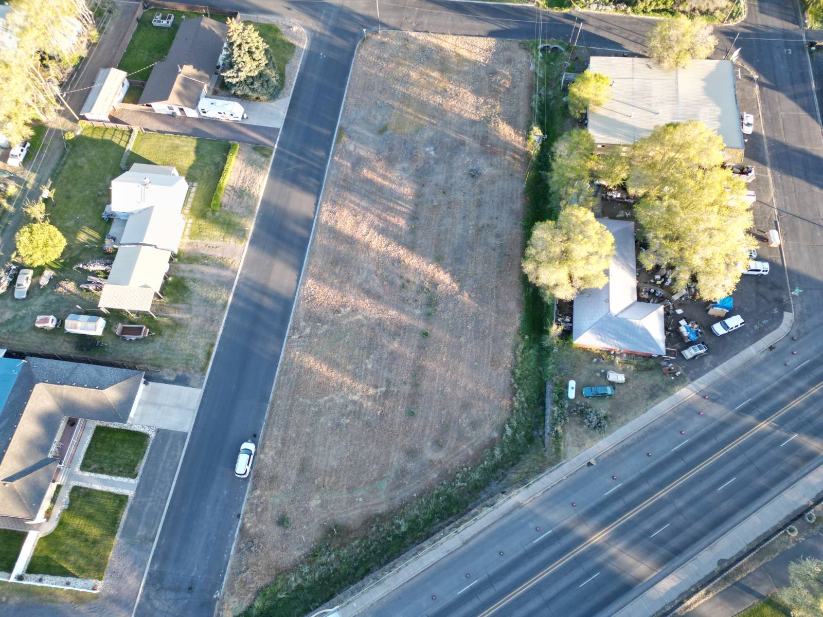
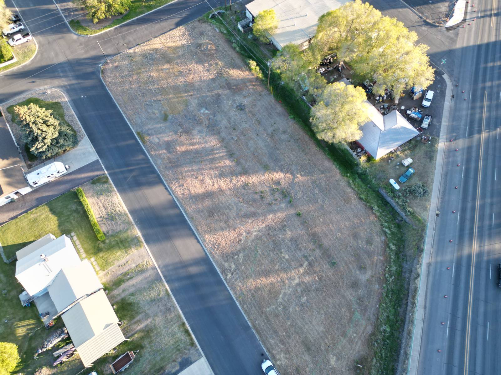
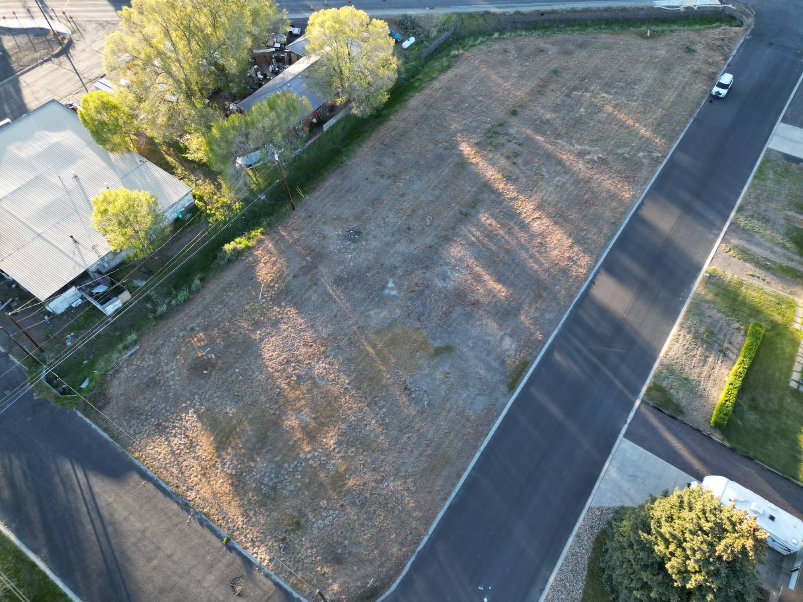
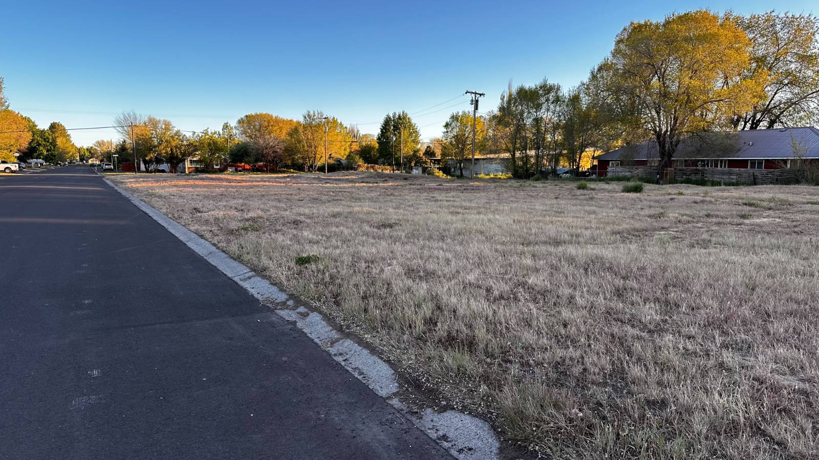
Commercial Land - Close to Highway

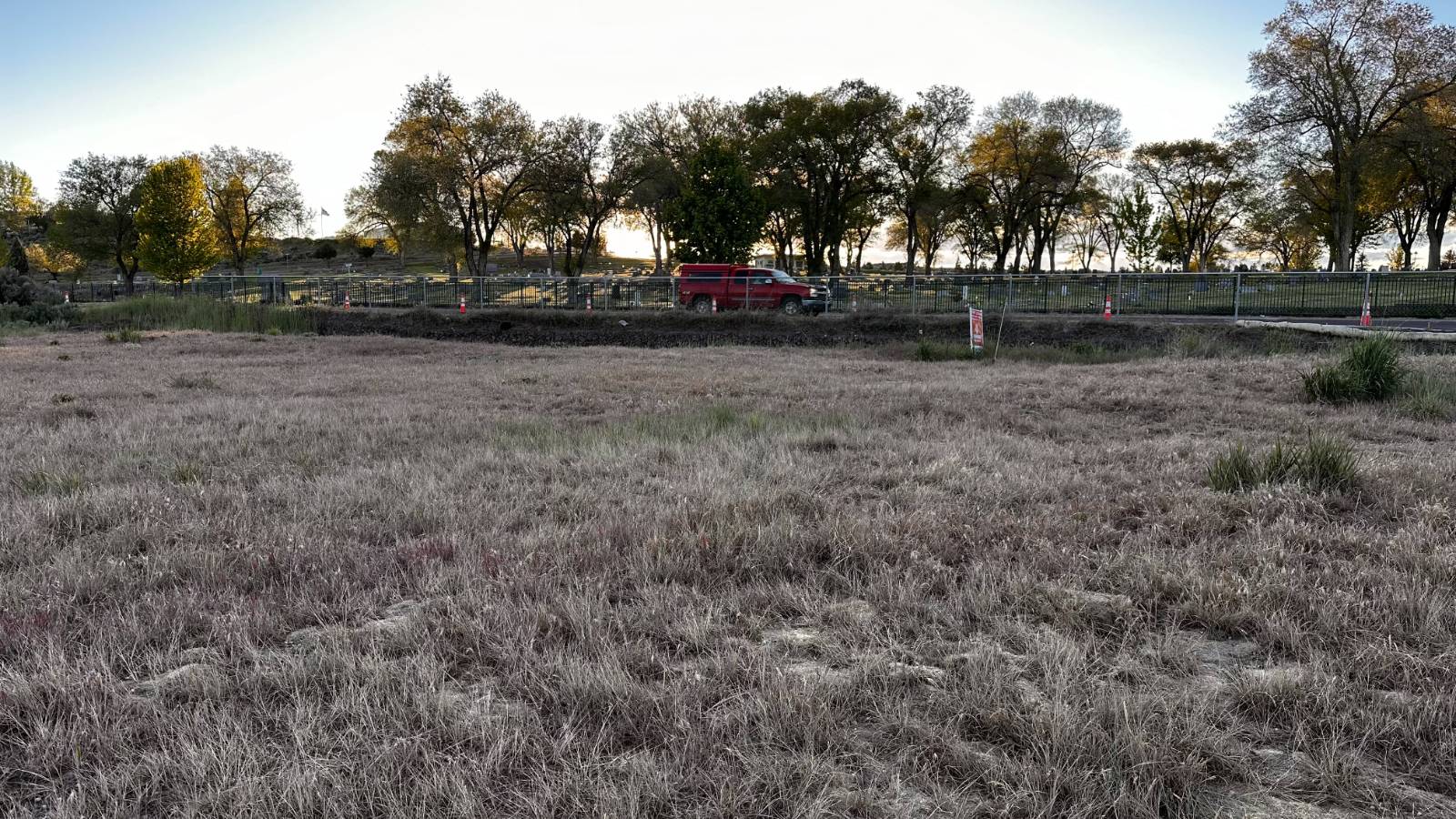
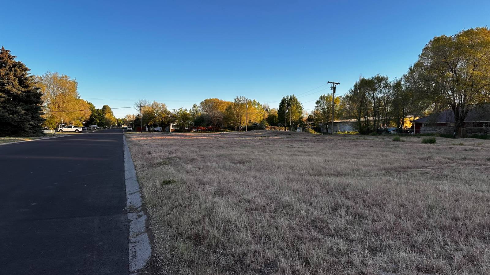
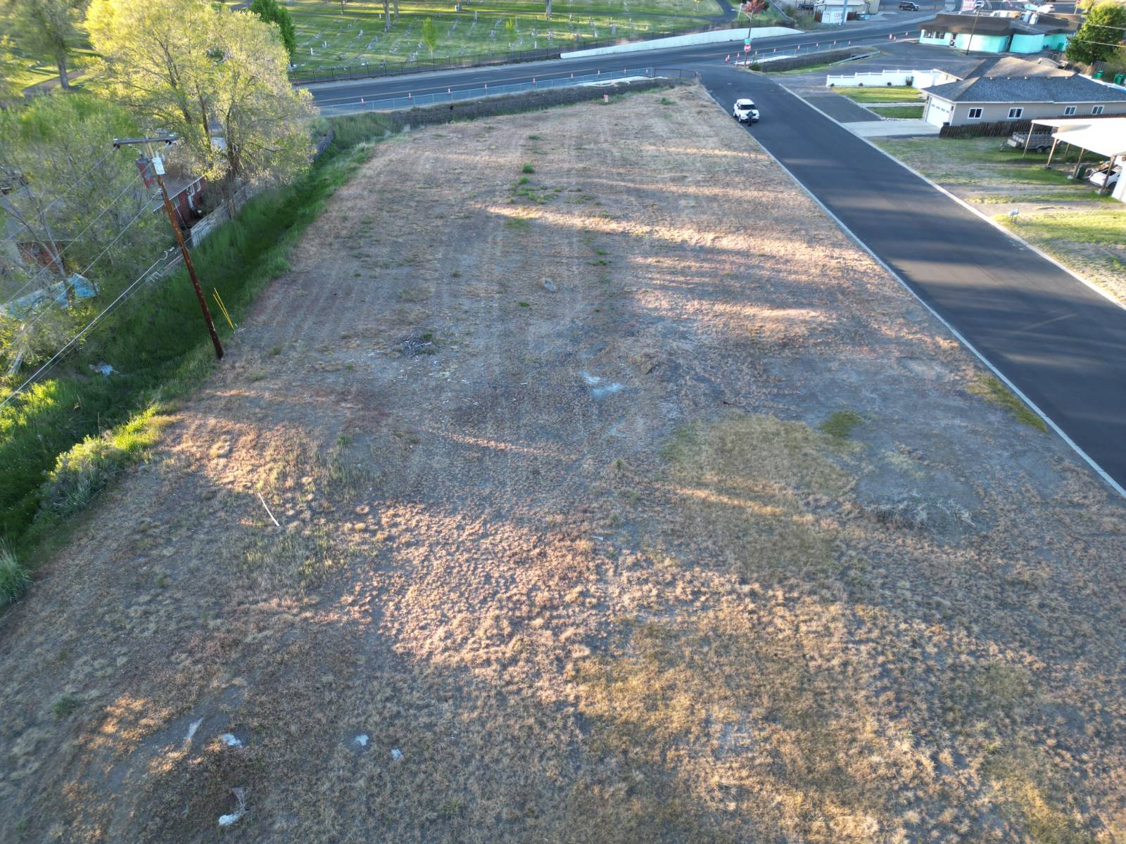
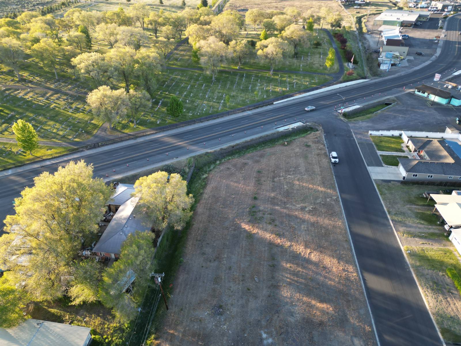
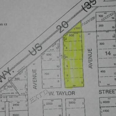
This property is one large tax lot encompassing six 50 x 100 platted lots and an extra partial corner lot. The land sits at the intersection of South Juntura Avenue and Highway 20/395 in Burns, Oregon. The land area is about 0.65 acre (+/-). It is zoned General Commercial (CG) with the City of Burns. This is a very busy traffic area and power, municipal water/sewer, and phone are all right near the property. Great access with paved streets on three sides. Easy to go and see.
Land Details
  • 0.65 Acres
Taxes and Fees
  • $548 County Tax
  • $548 Total Tax
Listed By
Paramore Real Estate
Office: 541-573-3639
Request More Information
Request Showing
Your Preferred Date & Time
Showing Type:
Request Cobroke

If you're not a member, fill in the following form to request cobroke participation and start the signup process.

Listing data is deemed reliable but is NOT guaranteed accurate.
Contact Us
Who Would You Like to Contact Today?

I want to contact an agent about this property!

I wish to provide feedback about the website functionality

Contact Agent
Your Name:
Email:
Phone:
Message:
Security: What is 8 minus 3?